Title: Songwe River to Kigali (Rwanda)
Dates: 27th May to 8th June GPS:
Distance: 1385km Total Distance: 17,068km
Roads: 873km gravel, sand; 512km tarmac – high mountains, long climbs, rolling hills in central Tanzania
Weather: high 20s, early 30s, prevailing easterly winds (cross winds)
 Finally I have managed to draw a new route map which shows the first 17,000km of the journey. Please click on the adjacent icon to see an accurate representation of the route so far (up to Kigali). Entering Tanzania, we moved forward into another time zone – we’re now only 7 hours behind Eastern Standard Time in Australia (and just 5 hours behind WA). The first day in Tanzania was all about sucking in as much air as possible and absorbing a new culture as I cycled from about 500metres near Lake Malawi to 2300metres before dropping back to 1700metres at Mbeya. Initially the road ascended through some wild jungle-like terrain, away from the lake and into the low-level clouds. I saw two troops of monkeys beside the road and stopped to try to film some of them. This wasn’t that easy because they always try to hide by keeping leafy branches in their line of view.
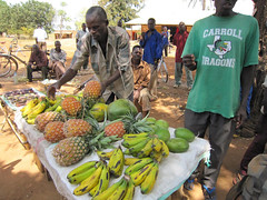
It started to rain heavily as I worked my way slowly up through some extensive tea plantations. Land use from then on became intensive with a variety of vegetables and fruit being grown on terraced plots and for sale beside the road. I was sodden by lunchtime (70km) and so John made soup to warm me up – and to go with the “Obama Buns” he had found in a small bakery. President Obama is a very popular man across Africa, but seems to be even more so as we near Kenya his country of birth. In Mali we saw “Obama” perfume in a store in the town of Nara. I’ve noted children wearing Obama t-shirts in most countries and we see Obama posters everywhere. The Obama buns were actually excellent – very sustaining.
 Near the summit I met a German cyclist, Ingor – another tourist riding to the World Cup in South Africa. He didn’t think he would make it to the first match which he reminded me was against Australia. I reminded him not to be too cocky about the match… In Mbeya, John checked with truck drivers who had recently travelled or knew about the route we planned to take through to Tabora. The word generally seemed to be that it was passable for a LandRover, but not a two-wheel drive vehicle. We had been worried about all the rain we were having around Lake Malawi, but the lake creates its own weather pattern and the high mountains form a barrier to the weather. Once over the next huge pass out of Mbeya, we would enter a rain shadow – dropping down to the high central plains. We decided to go for it. The route would be much shorter and I was eager to venture along this little travelled road through central Tanzania.
I was looking forward to tackling the first obstacle – the high pass dividing Mbeya from Chunya – and had psyched myself accordingly. There was no warm up climb – it was simply straight up out of the town. I immediately dropped into the lowest range of gears. The path was extremely steep and stony, so it was a matter of focusing on just in front of the wheel to keep upright.
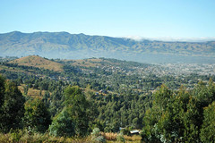
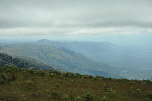
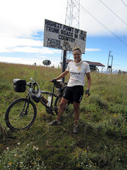 When I did have the opportunity to look up, the views were exceptional. Mbeya, one of Tanzania’s largest towns, gradually shrunk to appear as an insignificant mark within the immense scale of the valley. I felt extremely satisfied reaching the pass; a sign reminding me that it was the country’s highest trunk road. Whoever wrote the sign was about 500metres too generous with the altitude though, saying it was 2916metres rather than the 2466metres displayed on John’s GPS. The road then wound a convoluted path along a ridge, staying above 2000metres for at least 20km, before dropping down through some treacherous patches of bulldust and on to Chunya.
The following day was marred by slow punctures and a leaking oil seal on John’s rear axle and so we lost time attending to the breakdowns. Punctures are simple to fix, but the LandRover’s problem was potentially serious if John didn’t attend to it straight away. Replacing the seal was a fiddly job in the bush amongst accumulating numbers of sweat bees. Not too much time was lost however and I still clocked 106km, finishing in the dark.
 Sunday 30th May started alright and I enjoyed passing through a string of small villages. Then it all started to become heavy going as the path became sandy, especially along the low points. That wasn’t the worst of it though – just as I was struggling through deep sand I was bitten again and again by tsetse flies. Pretty soon a large angry swarm of tsetse hovered around and behind me. My clothes gave no protection. They could bite through my cycle shorts, shirt, gloves and socks. The bites are sharp and painful – sometime deep enough to draw blood. Give me the good ol’ Aussie fly any day. Australian bush flies are just annoying, and during my Australian expedition, once I generated some speed and brushed my shirt a few times I could lose them.
Tsetse however appear to be the athletes of the fly world. Even at 40km per hour, they would easily keep up – I could not lose them. John cycled out to meet me before the end of the first session and he too was attacked. They seemed to disappear in any inhabited area. When we stopped moving, they would soon lose interest and disappear. The trouble was that I had to cycle eight hours a day. For two days that meant I was continually attacked and found myself cycling faster and faster to try and get rid of them – to no avail.
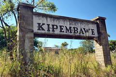 There were few villages marked on our map, but one was Kipembawe. We had expected to find the usual string of shops with little to buy and people milling around, chatting, selling from roadside stalls. Kipembawe was different though. It was completely dead – a ghost town. We never managed to confirm what we deduced from looking at the deserted buildings. A series of houses lined an overgrown street. They were solid well-made brick structures.
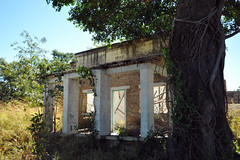 The date 1945 was painted on one facade and serial numbers branded each house. We think it was some sort of military outpost built at the end of the Second World War. By whom, we don’t know and no one seemed to know much about it. It was strange that it was deserted as usually in other places we have visited, locals would have moved into the houses or at least reuse all the materials.
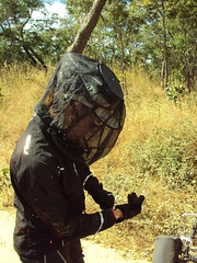 The tsetse problem worsened on second day. I started the day wearing a thick cotton long sleeved shirt which also protected my backside a little. They bit straight through that so I added a cycle jersey under it. The double layer of clothing worked, but they just concentrated on other body parts, especially my hands and the backs of my legs. Next I added a waterproof jacket and wrapped the shirt around my waist – a little better. Heading north from the remote village and mission of Kitunda, the problem worsened to a new level. I was travelling under a cloud of thousands of aggressive flies.
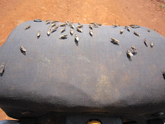 My barbag was coated with a thick mass of flies. (In the picture you see, I had tipped many of them off the barbag to retrieve my camera. I had to endure plenty of bites while I took the photo. John said that they would sit on the spare wheel of the vehicle and some would even keep speed as he drove, so he had to keep the windows closed. After lunch I resorted to desperate measures. My full suit of armour included; thick socks, double-lined track bottoms with a pair of cycle shorts over the top, cycle jersey and waterproof jacket, winter gloves, tape around my wrists because they kept finding the gap between glove and jacket, scarf, insect head net. It kept out the flies but was extremely hot. Nevertheless it was relief. There was a lot of sand and a few testing rough patches to endure too, but at least I could relax a little.
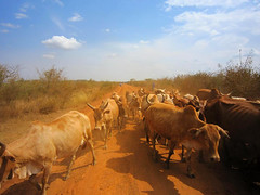 Despite the discomfort, we were travelling through a beautiful wild place with no people around – not even a car passed during the night. Setting off the next morning I was prepared for another battle with the tsetse, but it never eventuated. Just as fast as they descended upon us, they disappeared. I noted on the map that we had been travelling across the same latitude as when we encountered the tsetse in Angola, although the problem in Angola was only for about 40km and less intense than in Tanzania. About a kilometre from our campsite John noticed some lion footprints.
Tabora was a big friendly, relaxed African town. We enjoyed a day off there catching up on internet connections and bits and pieces. We’d been led to believe that that was the end of the rough unsealed road and so John switched tyres back to efficient road tyres. Six kilometres out of town however I was back on the dirt. It was heavy going for another day and a half before we finally rejoined the tarmac. Our next major concern was security between Kahama and the Rwandan border.
 Even a fellow in a small village, 15km before the bitumen warned that the region after Kahama was still full of refugees who fled from Burundi and Rwanda during and after the genocide. John quizzed a few truckies and learned that the real danger of being ambushed and robbed was after dark, so we proceeded with caution ensuring that we reached the safety of a hotel. This meant lopping off a couple of hours at days end to ensure we were set up before dark.
As we neared Rwanda, the land became very hilly and I was slowed up by a few long climbs. Rwanda is known as “Land of a Thousand Hills”, so I was expecting some hard work. Across the border at Rusumo (spectacular waterfall), many things changed dramatically. It was back to driving on the right hand side of the road. There were a lot more people. Rwanda is a tiny landlocked country with a population of 11 million. Rather than one cyclist joining me at a time, it was more like a peloton.
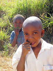
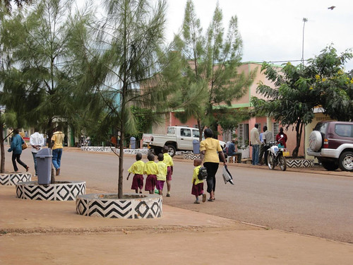
There were plenty of smiling faces and every time I stopped I was mobbed by a crowd of inquisitive children. There are no plastic bags in Rwanda and the streets are free of litter. Village main streets were clean and tidy with rubbish bins and gardens. There has been a lot of aid money pumped in to Rwanda to help citizens recover from the horrors of the genocide when at least two-thirds of the population were displaced and one million killed.
We made good time to reach Kigali a day early. Zdenek flew in on 9th June to rejoin the expedition. Our main goals were to visit the Millennium Village of Mayange, just south of the beautiful city and learn more about the genocide and how the nation is coping 16 years on.


{ 6 comments… read them below or add one }
absolutely fantastic Kate!
During German occupation of Tanganyika Kipembawe was very important ‘Half Way’ town between ITIGI (Rail Head) and Mbeya.
It was also a junction to ‘Path’ to Tabora, used by Caravans during preautomobile times.
My Father, an Indian trader played very important part in development of Irigi-Kipembawe-Mbeya route.
Hey Kate – We continue to be amazed by your extraordinary and inspiring journey. Stay safe. Gina, Heloise, Bonnie & Claudia
Hi Ash,
Thank you for helping me out with info about Kipembawe. Very interesting. Do you know what happened to it? It appeared as if it had been deserted all of a sudden. The buildings looked as if they were all built by the military in 1945.
Regards,
Kate
Hi Gina and girls,
Thanks for your encouragement. Just 2 months to go now. I am in Gulu, Uganda right now.
All the best,
Kate
hey kate, read your article. thanks. brought back a lot of old memories. my dad used to own a shop near the itigi railway station, close to the govt. school there, since 1950s i think. i have very fond memories of that place.